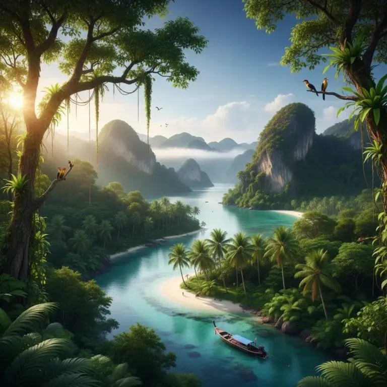
Thailand beckons those whose soul aspires to pristine beauty and thrilling adventures. If your pulse quickens at the thought of hiking, of the mesmerising dance of wild nature or of the magic of the underwater world, then the country's best national parks will become your personal paradise.
Here, at the intersection of majestic mountain trails and shimmering sea depths, real treasures are hidden. Feel the breath of the cool, mist-shrouded landscapes of Huai Nam Dang, where every step opens up new horizons. Immerse yourself in the verdant heart of Kaeng Krachan, making your way through the lush jungle, full of the rustle of the wings of birds of paradise and the elusive inhabitants of a secret life.
For those who are looking for something completely new, Thailand has prepared challenges and discoveries. Explore the mysterious labyrinths of the caves of Sam Roi Yot, keepers of age-old secrets, or plunge into the crystal purity of the waters of the Mu Ko Surin archipelago, where beneath the surface a grand spectacle of marine life unfolds.
Don't know where the beginning of your ideal Thai adventure is? This guide is your compass in the world of thrilling discoveries, which will help you plan a journey full of unforgettable impressions.
1. Kui Buri
The best place for observing wild nature
Kui Buri is one of the most interesting and at the same time underrated national parks of Thailand, located in the province of Prachuap Khiri Khan not far from the border with Myanmar. It is not as well known to the wide tourist audience as Khao Yai or Khao Sok, but among those who are interested in wild nature it has a special reputation. This park is often called one of the best places in the country for observing animals in their natural environment, and first and foremost — wild elephants.
The park was created relatively recently, in 1999, and occupies a territory of about 969 square kilometres. Its landscape differs from the classic tropical jungle that many expect to see in Thailand. Here dry forests, open plains and hilly areas predominate, which makes the territory more "visible". It is precisely this feature that became the key reason for its popularity among observers of wild nature: animals here are easier to spot than in dense moist forests, where they often remain hidden.
The main pride of Kui Buri is its population of Asian elephants. The park is considered one of the few places in Thailand where the probability of seeing elephants in the wild is genuinely high. Unlike many other parks, where encounters with large animals remain a matter of luck, here observing them has become an almost regular occurrence, especially at certain hours. Most often elephants come out onto the open grassy areas closer to evening, when the heat subsides. It is precisely at this time that special safari outings are organised, during which visitors are accompanied by rangers and guides.
But Kui Buri is interesting not only for its elephants. Gaurs also dwell here — the largest wild bulls of Asia, which make no less strong an impression thanks to their size and powerful build. In addition, in the park you can come across deer, macaques, various birds and other representatives of the local fauna. At the same time the atmosphere here remains very calm and less touristy than in the country's better-known national parks.
The peculiarity of Kui Buri is that it offers a format of animal observation rather rare for Thailand — almost as in the African savannahs, but in an Asian context. Open spaces, small bodies of water and grassy fields create conditions in which animals come out to feed and become noticeable even from a distance. At the same time the park strictly regulates visits in order to minimise the influence of humans on the behaviour of the animals. Independent trips around the territory are limited, and most of the observations take place in an organised format with accompaniment.
An important role in the development of the park was played by programmes for the preservation of wild nature and interaction with local communities. Previously conflicts existed in the region between people and elephants, but thanks to efforts to create a protected territory, improve the living conditions of the animals and develop ecotourism, the situation has gradually changed. Kui Buri has become an example of how it is possible to combine nature conservation and sustainable tourism development.
Visually the park may seem less striking compared to the karst landscapes of the south or the dense jungle of Khao Sok, but its strength lies elsewhere. There is no "postcard" drama here, but instead there is a feeling of real wild nature, where the animals are not part of a show or a specially prepared route. This is a place about observation, patience and respect for the natural environment.
Kui Buri is especially valued by those who want to see Thailand from a different side — not through beaches, temples or popular tourist routes, but through living nature and a real ecosystem. This is a park where the impression is built not on the number of attractions, but on one strong experience — an encounter with a wild animal in its natural environment. That is precisely why Kui Buri often remains one of the most memorable places for those who are genuinely interested in nature.
2. Sam Roi Yot
Best suited for exploring caves
Sam Roi Yot is one of the most beautiful and at the same time underrated natural places of Thailand. Usually this name is understood to mean the area on the coast of Prachuap Khiri Khan province and above all the Khao Sam Roi Yot national park. This place is not at all like classic beach Thailand with noisy resorts and dense urban development. Here the main image is not shopping streets and hotels, but limestone mountains rising almost right by the sea, wide marshy plains, mangrove areas, quiet beaches and a very calm rhythm of life. The name itself is usually translated as "the mountain with three hundred peaks", and it conveys well the character of the local landscape: the jagged karst massifs really do look as if a whole stone archipelago is rising up out of the land and water.
From the point of view of natural geography, Sam Roi Yot is especially interesting in that here several different ecosystems converge in one place at once. The national park is located on the shore of the Gulf of Thailand, about 58 kilometres south of Hua Hin. Its area is about 98 square kilometres, a noticeable part of which belongs to the marine waters. The park was created in 1966 and is considered the first coastal national park of Thailand. This is an important fact: Sam Roi Yot is valued not only for its beauty but also for the fact that it has long been protected as a unique natural territory of national significance.
The main feature of Sam Roi Yot is not only the mountains but also the wetlands. Here is located the largest freshwater marsh in Thailand, which makes the area especially important for birds, fish, reptiles and coastal flora. The international significance of this landscape is confirmed by the fact that the Khao Sam Roi Yot Wetland has been included in the list of Ramsar sites since 2008. The Ramsar Convention grants such status to territories that are considered valuable wetland ecosystems of a world level. For Sam Roi Yot this status is especially logical: here freshwater marshes and coastal marine areas are combined, and such a combination is in itself rather rare for the region.
To put it simply, Sam Roi Yot is a place where Thailand looks especially natural and almost cinematic. Against the background of plains and water rise sharp grey rocks, between them lie green marshes and thickets, and along the sea stretch calm beaches. Unlike the country's better-known national parks, here there is no feeling of a huge forest massif or mountain backcountry. On the contrary, Sam Roi Yot gives the impression of an open, bright, almost coastal protected space, where the sea, the karst and the moist plains form a single landscape. That is precisely why many consider it one of the most photogenic corners of Central and Southern Thailand.
The most famous place in Sam Roi Yot is, undoubtedly, the Phraya Nakhon cave. It has become a kind of visual symbol of the entire area. The cave itself is impressive already because in its vault there is a large natural opening through which sunlight falls inside. Thanks to this, at certain hours the space of the cave looks almost unreal: the stone vaults, greenery, shadow and the ray of light create a very theatrical effect. But the main detail is the small royal pavilion Khuha Kharuehat Pavilion, built for the visit of King Chulalongkorn in the 19th century. This pavilion inside the cave is one of the most recognisable images of Thailand in general, and not only of Sam Roi Yot.
The Phraya Nakhon cave is important not only as a beautiful spot for photographs. In it one feels the connection characteristic of Thailand between nature, royal history and the sacred perception of space. It is not simply a karst attraction and not simply a historical object. It is a place where the natural landscape seems to have itself become an architectural frame for a symbol of the monarchy. That is precisely why a trip to Sam Roi Yot rarely comes down to an ordinary walk: many visitors are left with the feeling that they have seen not just a national park, but one of the most expressive scenes of the Thai cultural landscape.
But Sam Roi Yot is far from being just one cave. A very important part of the impression of it is connected with the mangrove forests, canals and viewpoints. In the description by the Tourism Authority of Thailand, views of Khao Daeng Peak and Khao Daeng Canal are mentioned separately, where the water passes through mangrove areas and reaches the sea. This gives the park a special visual depth: here you can see not only rocks and beaches, but also the quiet, almost meditative life of the coastal marshes. Such routes are especially liked by those who love not "tick-box" attractions, but the observation of the landscape, the light, the birds and the slow movement of the water.
Sam Roi Yot is also highly valued for birdwatching. The wetlands make this area one of the most interesting ornithological spots in the country. Here a large number of waterfowl and near-water species are regularly recorded, and the territory itself is considered important for wintering and rare birds. That is precisely why the area is especially loved not only by ordinary travellers, but also by those who come to Thailand for nature in a narrower sense — with binoculars, a camera and an interest in ecosystems, and not only in a beach holiday.
At the same time Sam Roi Yot does not look like a harsh or hard-to-reach reserve. On the contrary, its special charm lies precisely in the combination of wildness and accessibility. There are routes here that are suitable for an unhurried acquaintance with nature, there are beaches from which you can begin the way to the cave, there are wooden boardwalks across the marshy areas, there are walks through the mangroves and viewpoints with very expressive panoramas. Thanks to this, Sam Roi Yot is liked both by those who want an active day in nature and by those who are simply looking for a calmer alternative to the overcrowded tourist locations near Hua Hin.
If you compare Sam Roi Yot with other well-known natural places of Thailand, then its strength is not in scale and not in dramatic "wildness", but in harmony. Here there is no feeling that nature overwhelms man. Rather the opposite: the landscape looks majestic, but at the same time open and clear. The limestone peaks, the calm sea, the deserted stretches of beach, the marsh grasses, the birds and the light inside the cave create a very integral image. This place is well suited for those who want to see Thailand not only as a country of temples and islands, but also as a country of very subtle, multi-layered natural landscapes.
If you formulate it very briefly, then Sam Roi Yot is one of the most expressive natural corners of Thailand: the country's first coastal national park, a territory of limestone mountains and the largest freshwater marshes, an area of internationally significant wetlands and a place where the famous Phraya Nakhon cave with the royal pavilion inside is located. This destination is not about a noisy holiday, but about the beauty of the relief, the silence, the birds, the karst landscapes and a very special feeling of space.
Address: "Khao Daeng", Kui Buri district, Prachuap Khiri Khan.
Opening hours: Daily from 8:30 to 15:00.
3. Khao Yai
Best suited for getting acquainted with waterfalls
Khao Yai is not just one of the most famous national parks of Thailand, but a natural territory with international status and a very strong reputation among lovers of wild nature. When it is spoken of in a serious context, usually what is meant is not only the park itself, but also its role as part of the large protected forest massif Dong Phayayen–Khao Yai Forest Complex, which was inscribed on the list of UNESCO World Heritage in 2005. Moreover, this is about not the separate protection of one park, but a serial property, uniting at once five almost adjacent protected territories: Khao Yai National Park, Thap Lan National Park, Pang Sida National Park, Ta Phraya National Park and Dong Yai Wildlife Sanctuary.
It is precisely this that makes Khao Yai especially important. Its value for UNESCO is connected not only with beautiful views, waterfalls and forests, but with the fact that it is part of a large natural complex with an area of 615,500 hectares, stretching for about 230 kilometres. UNESCO emphasises that this forest massif has international significance for the preservation of biodiversity and serves as a refuge for a large number of rare and vulnerable species. The description of the property speaks of more than 800 species of fauna, including 112 species of mammals, 392 species of birds and about 200 species of reptiles and amphibians.
Therefore Khao Yai is perceived not as "just a beautiful park near Bangkok", but as part of one of the key natural landscapes of mainland Thailand. This place is important both as a forest corridor and as a watershed territory feeding several of the country's large rivers. For the traveller this means a simple thing: a trip to Khao Yai is not a walk through a decorative park, but an acquaintance with a real living ecosystem, where wild nature is preserved on a large scale, and not in the form of separate tourist zones.
A separate reason why Khao Yai is so often mentioned in guidebooks and reviews of the nature of Asia is its wild elephants. UNESCO directly classes the Asian elephant among the protected species for whose sake the whole complex has international nature-conservation value. The official materials of the park itself specify that about 140–200 elephants dwell in Khao Yai, and they are considered the largest mammals on its territory.
Because of this Khao Yai is indeed often mentioned as one of the best places in Asia, and all the more so in Southeast Asia, for observing wild elephants. Here it is important to make a precise caveat: this is not an official UNESCO title and not a formal rating, but a steady reputation formed thanks to a combination of several factors — the relatively high probability of encounters, the large protected territory, the accessibility of the park for visitors and the fact that elephants here can be seen precisely in their natural environment, and not in the format of a show or a "contact" tourist attraction. Official tourist and park sources confirm that elephants in Khao Yai are encountered regularly, and the park is known among visitors precisely for the possibility of observing large wild fauna.
Moreover, the peculiarity of Khao Yai is that observing elephants here does not always require a complex multi-day expedition. On the official website of the park it is directly stated that Khao Yai is a place where wild elephants can be seen quite close, including at the roadsides and even on the road itself, because some routes cross the traditional paths of their movement. This sounds striking, but at the same time explains why the park takes the safety rules so seriously: the proximity to the animals here is not staged but real, and that is precisely why it requires caution and respect for distance.
Another important point is that in Khao Yai wild nature is active not only during the day. The park officially offers a night safari, and in the description of this activity the animals that can be observed in the evening hours are directly listed, including the wild elephant. This reinforces Khao Yai's reputation as one of the most interesting parks of the region for those who want not just to see the forest, but to genuinely increase the chance of an encounter with large animals in their natural environment. At the same time the administration specially prohibits independent night trips in one's own car for the safety of people and animals, which once again emphasises: this is about a real wild landscape, and not a controlled safari park.
Besides elephants, Khao Yai is also valued for the richness of its other fauna. The Tourism Authority of Thailand notes that the park is known for its variety of animals, and among the frequently spotted species names elephants, deer, gaurs and barking deer. The park itself emphasises that here you can also come across other charismatic animals — gibbons, macaques, hornbills, sambars, muntjacs and wild dogs. That is precisely why Khao Yai attracts not only those who dream of seeing an elephant, but also wildlife photographers, birdwatchers and travellers for whom a "living" Asia matters, and not only temples and cities.
If you formulate it briefly, then Khao Yai is important in two dimensions at once. Firstly, it is part of a UNESCO World Heritage Site since 2005, moreover as part of a larger forest complex uniting several national parks and a protected territory. Secondly, it is a park that is especially famous for observing wild elephants: not in a decorative but in a genuine natural setting, where the chance of seeing animals is indeed higher than in many other places in Asia accessible to tourists.
Location: Nakhon Ratchasima province.
Opening hours: daily from 06:00 to 18:00.
4. Kaeng Krachan
The best place for picturesque views
Kaeng Krachan is one of the largest and at the same time least overcrowded national parks of Thailand. It is located on the border with Myanmar, in the provinces of Phetchaburi and Prachuap Khiri Khan, and is considered the largest national park in the country: its area exceeds 2900 square kilometres. In essence, this is not just a park, but a huge natural massif, where wild nature is preserved in its most natural form, without strong "adaptation" to mass tourism.
The key feature of Kaeng Krachan is its scale and the feeling of a real, deep tropical environment. Unlike the more popular parks of Thailand, where the routes and the observation of animals are often structured and accessible, here nature feels more closed and complex. Dense forests, hills, mountain areas, rivers and reservoirs form a landscape in which a person is more of a guest than an observer from the side. This is a place not about quick walks, but about a gradual immersion in the natural environment.
The international significance of the park was officially recognised in 2021, when Kaeng Krachan was included in the list of UNESCO World Heritage as part of the larger natural property of the Kaeng Krachan Forest Complex. This complex also includes other protected territories, forming a single ecological region. Such a unification is important, because it is about not a local reserve, but a large forest massif, which plays the role of a natural corridor between Thailand and Myanmar. It is precisely thanks to this that populations of rare animals are preserved here, animals which need large territories to survive.
The biodiversity of Kaeng Krachan is considered one of the richest in the country. Here dwell Asian elephants, gaurs, Malayan bears, various species of wild cats, including leopards and clouded leopards, as well as many primates. At the same time encounters with large animals are not guaranteed and require patience, which, however, only reinforces the feeling of real wild nature. The park is especially known among lovers of ornithology: here more than 400 species of birds have been recorded, including rare tropical species and hornbills. Kaeng Krachan is also famous for its variety of butterflies, which in certain seasons gather in large quantities by the water and the moist areas of the forest.
The landscape of the park is largely determined by the combination of mountains and water. One of the central points is the Kaeng Krachan dam and the large reservoir, around which some of the most picturesque views are formed. Morning mists rising above the water and the forests create a soft, almost unreal atmosphere. In the higher parts of the park, for example in the area of Phanoen Thung, one can observe the so-called "sea of mist" at dawn — one of the most impressive natural views in Thailand.
The climate here is humid, and Kaeng Krachan is considered one of the rainiest regions of the country. Thanks to this the forests look especially dense and saturated, but the weather conditions can complicate travel. In the rainy season many roads become hard to pass, and movement requires preparation and suitable transport.
A visit to the park has its peculiarities. Some zones are accessible only on four-wheel-drive vehicles, and movement along certain routes is regulated by the administration. In certain periods advance booking is required, and entry may be carried out in organised groups or convoys. This is connected not only with convenience, but also with the need to preserve the ecosystem and ensure the safety of visitors.
The infrastructure in Kaeng Krachan is fairly basic. Here there are campsites and simple huts, but there is no feeling of a resort or a developed tourist zone. This makes the park especially attractive for those who are looking for a more "pure" natural experience without excessive commercialisation.
If you compare Kaeng Krachan with other well-known national parks of Thailand, the differences become obvious. Khao Yai is more accessible and convenient for short trips, Sam Roi Yot attracts with its compactness and expressive landscapes, while Kaeng Krachan is above all scale, depth and the feeling of real wild nature. Here what matters is not the list of attractions, but the very process of being in the forest, observing nature and the feeling of space.
In the end Kaeng Krachan can be called one of the most authentic natural destinations of Thailand. It is a territory where wild nature is preserved on a large scale, where there are fewer guarantees of seeing something specific, but much more chance of feeling the real strength and integrity of the tropical landscape.
Address: Kaeng Krachan, Kaeng Krachan district, Phetchaburi 76170.
Opening hours: daily from 05:00 to 19:00.
5. Erawan National Park
The best place for swimming
Erawan National Park is one of the most famous natural places of Thailand and, perhaps, one of those parks that most often become for travellers the first real acquaintance with Thai wild nature beyond temples, islands and cities. It is located in the province of Kanchanaburi, in the west of the country, in the area of the Tenasserim limestone mountains, and is considered the twelfth national park of Thailand: it received official protected-territory status in 1975. The park occupies about 550 square kilometres, so Erawan is not only the famous waterfall that tourists most often see, but also a fairly large natural zone with forests, hills, streams, caves and a diverse fauna.
The main reason for Erawan's fame is the Erawan Waterfall, which is considered one of the most beautiful natural attractions of the country. Its peculiarity is that it is not one powerful stream, but a long cascade of seven levels, stretching for about a kilometre and a half. The water descends along the limestone ledges, forming transparent turquoise-emerald pools in which one can swim. It is precisely this combination — the soft colour of the water, the stepped cascades, the tropical greenery and the light stone — that has made Erawan a visual symbol of natural Thailand. The upper tier, according to a common explanation, reminded people of the head of the mythical three-headed elephant Erawan, and it is precisely from this image that the park got its name.
Erawan makes a special impression because here nature looks both bright and accessible. Many national parks of Southeast Asia require serious preparation, long journeys or difficult treks, whereas Erawan is perceived much more friendly. The way to the waterfall is relatively convenient, and the seven levels themselves create a feeling of gradual immersion in the forest: the lower cascades usually seem more open and lively, while as you climb the space becomes quieter, greener and a little more secluded. Because of this, a visit to Erawan is often remembered not as one specific view, but as a sequence of natural scenes succeeding one another.
At the same time Erawan is not only a place for beautiful photographs, but a full-fledged national park with notable natural diversity. Within its limits mixed deciduous forests predominate, and dry evergreen and dipterocarp areas are also found. Such a combination forms a fairly rich habitat for animals. According to sources about the park, here are found elephants, wild boars, sambars, gibbons, langurs and other mammals, while the avifauna numbers hundreds of species of birds. For most visitors the wild nature of Erawan remains more of a background than the main goal of the trip, but it is precisely this that makes this place not just a beautiful waterfall, but a living protected ecosystem.
Another important feature of Erawan is the limestone relief. Thanks to it the park is interesting not only for its water cascades, but also for its caves. In descriptions of Erawan several large caves are regularly mentioned, including Mi, Phartat, Rua and Wang Bahdan. This adds additional depth to the park: it is perceived not as a single place with water, but as a more complex natural landscape, where forest, rocks, underground cavities and streams are combined. It is precisely the limestone that is largely responsible for that very characteristic colour of the water, which makes Erawan so recognisable.
For many travellers Erawan is especially valuable in that here the "physicality" of nature is felt very clearly. This is not a park that you look at only with your eyes. Here the sound of the water, the coolness by the cascades, the moist air, the feeling of stone underfoot, the sharp change of sun and shadow, the contact with the forest almost at the level of physical presence — all matter. Even the famous fish in the lower pools, which swim up to the bathing people, have become part of the local recognisability. All this makes Erawan a place that is perceived not as an abstract attraction, but as a direct natural experience.
For all its popularity Erawan does not come down to mass tourism. Its significance for Thailand is connected also with the fact that it is one of the most well-known examples of nature conservation in a format understandable to the widest circle of people. It shows how a national park can simultaneously be both a tourist magnet and a space of ecological value. On the one hand, people come here for swimming, a walk and the impressive colour of the water. On the other — the very fact of the preservation of this territory in the status of a national park over the course of decades speaks of the fact that Erawan remains an important part of the country's natural heritage.
If we speak of the perception of Erawan in the broader context of Thailand, then it can be called one of the most "understandable" national parks of the country. It does not require special knowledge to be liked. The beauty here is read immediately: the cascades, the forest, the natural pools, the limestone ledges, the soft light and the saturated greenery create the image of an almost ideal tropical waterfall. But the more attentively you look at this place, the clearer it becomes that its attractiveness is not only external. Erawan is interesting as a landscape, as an ecosystem, as an example of a nature-conservation territory and as one of those places where Thailand reveals itself not through culture and architecture, but through water, stone and forest.
Address: Tha Kradan, Si Sawat district, Kanchanaburi 71250
Opening hours: Daily from 8:00 to 15:30
6. Mu Ko Ang Thong
The best place for getting acquainted with marine life
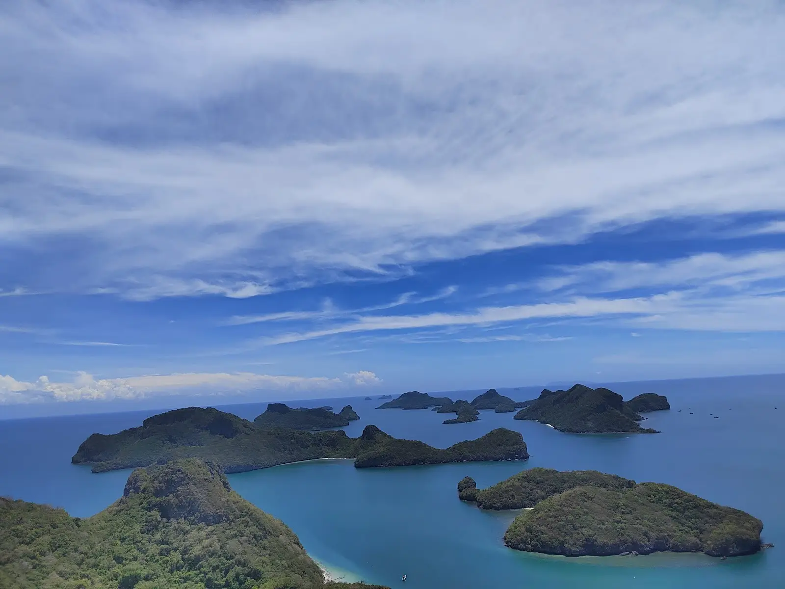
Mu Ko Ang Thong is one of the most impressive marine national parks of Thailand, a place where the landscape looks almost unreal even by Thai standards. This is about an archipelago in the Gulf of Thailand, to the west of Samui and Phangan, which consists of about forty-odd islands and is protected as a marine national park. The perception of this place is built not on one specific beach or one attraction, but on the general visual effect: dozens of limestone islands rise out of the brightly turquoise water, between them lie narrow straits, small bays, hidden beaches and green slopes, because of which the whole archipelago seems like a huge natural labyrinth.
The main feature of Mu Ko Ang Thong is that it is precisely a marine park, and not just a beautiful group of islands. Here the whole natural complex matters at once: the sea, the karst rocks, the coastal forests, the coral areas, the lagoons and the viewpoints. On land these islands look harsh and almost impregnable, but from the water they seem especially picturesque: the green hills and grey limestone walls are reflected in the calm water, and the distances between the islands create an endless change of perspectives. Thanks to this, Mu Ko Ang Thong is perceived not as a resort in the usual sense, but as a natural setting of a very high level, where the main impression is given by the very geography of the archipelago.
The most famous place in the park is Talay Nai, or the so-called Emerald Lake, located on the island of Mae Ko. In essence this is an inner salt lake surrounded by steep cliffs, which is connected with the sea by underground channels. It is precisely this that has become one of the symbols of Mu Ko Ang Thong, because the combination of the emerald water, the stone walls and the almost enclosed space makes a very strong impression. This place is often described as a natural lagoon inside an island, and there is a certain accuracy in that: the lake looks like a hidden sea bowl, concealed among the karst forms. It is not so much large in scale as spectacular in composition, and that is precisely why it remains one of the most recognisable points of the entire archipelago.
Another most important image of Mu Ko Ang Thong is connected with the island of Wua Ta Lap, where the park headquarters and one of the best viewpoints are located. The climb to the observation platform is comparatively short, but rather steep, and it is precisely from it that that very panoramic view opens up, with which the whole archipelago is most often associated: a stretched-out chain of islands, light water, narrow passages between the hills and a feeling of an almost pristine sea. Wua Ta Lap is important also because it gives the visitor a more "earthly" acquaintance with the park: here there is a beach, a trail, the Bua Bok cave and basic infrastructure, so the island becomes not just a point of landing, but a place where one can physically feel the relief and scale of this marine space.
The nature of Mu Ko Ang Thong is especially expressive precisely in the combination of land and sea. This is not an archipelago with wide urban life, hotels and roads, as on the large Thai islands. Most of the islands here are uninhabited or almost not used by humans, and because of this the park retains a feeling of being a reserve. The strongest impression is made by the contrast between the dense tropical greenery on the slopes and the clean light water around the karst bases. That is precisely why Mu Ko Ang Thong is often perceived as a place not so much for a "holiday on an island", as for observing the very form of the sea: here boat routes, kayaking, views from the water and the feeling that you are moving through a whole natural archipelago, and not between separate tourist points, are very important.
Another important feature of Mu Ko Ang Thong is its accessibility despite its outward wildness. Usually people come here on a one-day sea excursion from Samui or Phangan, although in the park there is also the possibility of staying in simple accommodation or at a campsite. This makes the archipelago especially attractive: it looks remote and almost untouched, but at the same time remains quite reachable for the ordinary traveller. Such a combination is rare. Very often the most spectacular marine landscapes require long logistics, but here one of the most famous natural landscapes of Thailand can be seen within a relatively short trip. That is precisely why Mu Ko Ang Thong is so firmly fixed in the image of the "obligatory" marine nature of the south of the country.
If we speak of the impression as a whole, Mu Ko Ang Thong is a place where Thailand reveals itself not through beach comfort and not through cultural monuments, but through an almost perfect marine geometry. Here everything is built on the line of the horizon, the silhouettes of the islands, the emerald lagoons, the white sand in separate bays and the endless change of light on the water and the rocks. This is an archipelago that makes a strong impression even on those who have already seen many islands in Southeast Asia, because its beauty is not decorative but structural: it is created by the relief itself, the very arrangement of the sea and the very scale of the natural space. Therefore Mu Ko Ang Thong remains one of the most expressive marine parks of Thailand and one of those places where the word "archipelago" really feels like something big, integral and alive.
Address: Samui district, Surat Thani 84280
Opening hours: Daily from 9:00 to 17:00
7. Khao Sok National Park
Best suited for hiking
Khao Sok National Park is one of the most expressive natural places of southern Thailand, a territory where the tropical forest, limestone rocks, rivers and a lake come together into an integral landscape of almost pristine nature. It is located in the province of Surat Thani and is officially considered the 22nd national park of Thailand: the park was created in 1980, and its area is about 738–739 square kilometres. In official tourist materials of Thailand, Khao Sok is described as the largest area of rainforest in the entire southern part of the country.
The main reason why Khao Sok makes such a strong impression is the combination of several natural worlds at once. Here there is a dense evergreen forest, limestone mountains, deep valleys, karst formations, streams, marshy areas and the large Cheow Lan reservoir, which is also called Cheow Lan Lake or Rajjaprabha Lake. The water, the rocks and the forest here are not separated but literally grow into one another, because of which the park is perceived not as a set of separate attractions, but as a single living landscape.
A special place in the image of Khao Sok is held precisely by the ancient forest. The official website of the park and the materials connected with it call it one of the oldest evergreen rainforests in the world. It is precisely this thought that often becomes central in stories about Khao Sok: this is about not just a green massif, but a natural environment with a very deep geological and biological history. In combination with the high limestone cliffs this creates a feeling as if the park exists outside ordinary tourist time.
The landscape of Khao Sok is largely built on karst. The limestone peaks rise sharply above the forest and the water, forming one of the most recognisable natural silhouettes of southern Thailand. These rocks look especially spectacular against the background of Cheow Lan Lake, where separate peaks seem to grow straight out of the emerald surface of the water. That is precisely why many compare the views of Khao Sok with the most dramatic tropical landscapes of Southeast Asia: here there is both scale, and verticality, and a feeling of natural power, which is rarely found in "softer" landscapes.
Cheow Lan Lake has become for Khao Sok almost as much a symbol as the forest itself. It occupies about 165 square kilometres within the limits of the park and is known not only for its beauty, but also for its special atmosphere. This is one of those places where nature seems both grand and very calm: the smooth water, the morning mist, the reflections of the rocks and the forest create the impression of an almost complete isolation from the outside world. It is precisely on the lake that the famous floating houses and boat routes are located, thanks to which Khao Sok is perceived not only as a park for hikes, but also as a place for the slow contemplation of nature.
At the same time Khao Sok is not a park of one panorama. Its natural value is connected also with its great biodiversity. In open descriptions of the park, Asian elephants, Malayan tapirs, sambars, gaurs, wild boars, bears, macaques, langurs and white-handed gibbons are mentioned. For the traveller this means that Khao Sok is interesting not only visually, but also as a space of real tropical life. The animals here are not always easy to see, and it is precisely in this that an important feature of the park lies: it remains not a decorative natural zone, but a full-fledged ecosystem, where a person does not control all the encounters with wild nature.
Besides mammals, the park is known for its birds, insects, rare plants and cave systems. In materials about Khao Sok it is regularly emphasised that here there are caves, waterfalls and areas of forest where to this day a feeling of little-explored depth is preserved. This is an important detail for understanding the character of the place: Khao Sok does not look completely "read" by man. Even with developed tourism it retains a reputation as a space in which nature is not fully subordinated to the routes and expectations of visitors.
A very strong impression Khao Sok makes precisely as a park of contrasts. On the one hand, it is quite accessible for travellers: people come here for canoeing along the Sok river, for boat excursions on the lake, for walks through the jungle and for night safaris. On the other hand, even the most popular routes do not destroy the main feeling — that around you is a huge, moist, ancient and genuinely living forest. It is precisely this combination of accessibility and authenticity that makes Khao Sok so appealing. It does not require mountaineering preparation, but at the same time gives the experience of big nature, and not just of a beautiful park for photographs.
Another reason for the popularity of Khao Sok is its visual integrity. In Thailand there are many beautiful places, but not everywhere does the natural image come together so clearly and powerfully. Here there is a forest that is perceived as ancient; there are rocks that make the landscape almost prehistoric; there is a lake adding silence and reflection to the space; there is mist, caves, a river and a feeling of constant moisture, life and growth. All together this makes Khao Sok one of those national parks that are remembered not by a separate point, but by the general feeling of presence inside a large tropical ecosystem.
If we speak quite precisely, Khao Sok is not just a popular natural excursion in the south of Thailand. It is one of the most important forest landscapes of the region, the largest zone of rainforest in the southern part of the country, a park with a powerful karst relief and one of the most famous lake landscapes of Thailand. It is valued not for one attraction, but for a rare feeling of scale, antiquity and natural integrity. That is precisely why Khao Sok is often perceived as a place where Thailand opens up from a different side — not through beaches and cities, but through forest, water, stone and silence.
Location: Phanom district, Surat Thani province. Opening hours: daily from 07:00 to 19:00.
8. Ao Phang Nga
Best suited for water activities
Ao Phang Nga is one of the most recognisable natural places of southern Thailand, where the sea, limestone rocks and mangrove forests come together into a landscape that has long become a visual symbol of the whole country. This is about not just a beautiful bay, but a marine national park in the province of Phang Nga on the coast of the Andaman Sea. The national park was officially created on 29 April 1981, and its territory encompasses both marine and coastal areas in the districts of Mueang Phang Nga, Takua Thung and Ko Yao. In official Thai tourist materials the area of the park is indicated as about 250,000 rai, that is approximately 100,000 acres.
The main impression of Ao Phang Nga is born from its relief. This is not an open sea with a long line of the horizon, but a huge bay filled with limestone islands and rocks that rise almost vertically out of the water. These karst towers create a feeling as if the sea here has been turned into a complex natural labyrinth. Some islands look like massive green hills with sheer walls, others — like narrow stone columns, growing straight out of the bay. Thanks to this Ao Phang Nga is perceived not as one specific place, but as a whole system of straits, bays, hidden lagoons and stone silhouettes, which constantly change depending on the light, the tide and the angle of view.
Special fame the bay was brought by the island of Khao Phing Kan and the rock of Ko Tapu standing next to it. It is precisely this place that received worldwide fame after the filming of the James Bond movie "The Man with the Golden Gun", because of which it is often called James Bond Island. However, to reduce the whole of Ao Phang Nga only to this cinematic association would be too much of a simplification. In fact the value of the bay is much wider: the famous rock has become only one of the points through which the world saw a whole unique marine landscape. Even without the cinema this area would remain one of the most expressive natural images of Thailand thanks to its rare geology and almost theatrical composition of sea and stone.
But Ao Phang Nga is important not only for its rocks. One of its main natural values is considered to be the mangrove forests. In descriptions of the park it is emphasised that here are located some of the largest and best-preserved mangrove massifs of Thailand. For the ecosystem of the coast this is of huge significance: the mangroves protect the shore, soften the impact of storms and serve as a natural environment for the breeding and shelter of many marine species. Therefore the bay is valued not only as a beautiful landscape, but also as a living coastal ecosystem, where land, brackish water, the root systems of the mangroves and a rich marine world are combined.
It is precisely this combination that makes Ao Phang Nga especially interesting. On the one hand, it seems an almost postcard place — bright water, green islands, whitish rocks, longtail boats. On the other hand, behind this beauty lies a complex natural structure: marine channels, limestone massifs, mangrove zones, coastal caves and areas where land and sea penetrate into one another. Therefore a trip to Ao Phang Nga is not just a sea cruise, but an acquaintance with one of the most unusual coastal landscapes of Southeast Asia.
Another important feature of this place is its spatial expressiveness. In Thailand there are many beautiful islands, but far from everywhere does the natural image come together so clearly and powerfully. In Ao Phang Nga the beauty is built not so much on beaches as on the form of the space. Here the main thing is the silhouettes of the islands, their almost vertical walls, the narrow passages between the rocks, the hidden lagoons and the feeling that the sea here has become part of a stone world. Because of this the bay is especially loved not only by ordinary travellers, but also by photographers, kayakers and those for whom the very relief of the place matters, and not only a holiday by the water.
For all its fame Ao Phang Nga does not look like a classic resort area. It is rather a natural stage, where a person is present temporarily and cautiously. People come here not for city life and not for great beach comfort, but for the feeling of movement through an archipelago of rocks, caves and mangrove passages. That is precisely why the best impressions of the bay are usually connected not with standing on one shore, but with moving across the water, when the space gradually reveals itself: behind one rock a new bay appears, behind a narrow passage — another group of islands, and behind a mangrove channel — an entirely different rhythm of nature.
If we speak in general, Ao Phang Nga is one of those places where the natural power of Thailand is expressed especially clearly. Here there is no feeling of accidental beauty. On the contrary, the whole bay is perceived as an integral natural organism, where geology, sea and coastal vegetation form a rare balance. That is precisely why Ao Phang Nga remains not just a famous attraction of the south of the country, but one of the most characteristic and impressive marine landscapes of all Thailand.
Address: Ko Panyi, Mueang Phang Nga district, Phang Nga 82000. Opening hours: daily from 8:30 to 16:30.
9. Mu Ko Surin
The best place for diving
Mu Ko Surin is one of the cleanest and least urbanised marine corners of Thailand, an archipelago in the Andaman Sea off the coast of the province of Phang Nga, not far from the maritime border with Myanmar. Officially this territory has been protected as a national park since 9 July 1981. The archipelago includes five islands: Ko Surin Nuea, Ko Surin Tai, Ko Ri, Ko Khai and Ko Klang. According to tourist and park descriptions, this place is valued above all for the feeling of remoteness, the transparent water, the white sand and a very strong underwater component: Mu Ko Surin is perceived not as a beach resort, but as a natural marine park, where the main treasure is hidden not in the hotels and infrastructure, but in the reefs, bays and the very structure of the island space.
The peculiarity of Mu Ko Surin is that it is an archipelago of comparatively small islands, where land and sea feel like a single ecosystem. According to Thai National Parks, about 76% of the territory of the park is sea, and this very accurately explains the character of the place. Here what matters is not only the beaches and the wooded slopes of the islands, but above all the coral areas, the shallows, the straits and the coastal zones, where life under the water is almost as significant as what is visible on the surface. Thanks to this marine dominance, Mu Ko Surin has long been considered one of the best places in Thailand for snorkelling and diving, and official tourist materials directly call it one of the best dive sites in the country.
Visually Mu Ko Surin differs from the more dramatic archipelagos with huge vertical karsts. Here the landscape is softer and calmer, but it is precisely in this that its strength lies. The two main islands, Ko Surin Nuea and Ko Surin Tai, are located very close to each other — they are separated by a shallow strait of about 200 metres, which itself has become a popular zone for snorkelling. This place shows well the character of the archipelago: Mu Ko Surin is valued not for one iconic postcard, but for an integral experience of the sea, where the water, the corals, the sandy areas and the green islands create a feeling of a quiet, almost untouched space.
The main reason why Mu Ko Surin holds a special place among the marine parks of Thailand is connected with the underwater world. The Tourism Authority of Thailand calls these islands a place with one of the richest diversities of marine life, and the materials about the potential nomination of the Andaman marine reserves for the list of UNESCO World Heritage emphasise that it is precisely Surin and Similan that are considered the most ecologically diverse coral reefs of Thailand. These materials speak of more than 700 species of marine fish, 140 species of marine crustaceans and 160 species of hard corals within the limits of this broader natural complex. This does not mean that the tourist will necessarily see this whole spectrum, but it is precisely such biological richness that forms the reputation of Mu Ko Surin as one of the most important marine natural areas of the country.
Therefore Mu Ko Surin is especially valued by those who go to Thailand not just for a view of the sea, but for living contact with the underwater environment. Here people often emphasise not only the beauty of the corals, but also the transparency of the water, thanks to which snorkelling becomes the main way of getting acquainted with the archipelago. In one of the materials of Tourism Thailand, Mu Ko Surin is even called the most beautiful place of shallow-water coral reefs in the country, and among the characteristic marine inhabitants clownfish and sea turtles are mentioned. This description conveys well not only the natural value, but also the emotional image of the place: the archipelago is perceived as a "quiet watercolour" of the Andaman Sea, where life under the water is almost always more important than what happens on the shore.
Another very important part of the image of Mu Ko Surin is the Moken people. The official description of the Tourism Authority of Thailand directly states that on Ao Bon beach on the island of Ko Surin Tai there is a Moken settlement, and this community is named the last of its kind in this territory. The Moken are a sea people of the Andaman region, traditionally connected with a semi-nomadic way of life, the sea, boats and sustainable forms of fishing. UNESCO materials also note that the Moken are an Austronesian people of about 2–3 thousand people, living in the Mergui archipelago and along the coasts of southern Thailand and Myanmar, and that their way of life in recent decades has come under the pressure of sedentarisation, tourism, nature-conservation regimes and other external factors. Therefore Mu Ko Surin is important not only as a natural park, but also as a space where marine culture and the natural environment to this day remain closely connected.
This cultural component makes the archipelago especially multi-layered. For the ordinary traveller Mu Ko Surin may at first look like an ideal place for a boat, a mask and snorkelling, but behind this beauty is hidden also the history of people who for centuries were part of the marine ecosystem, and not just its observers. That is precisely why the islands are perceived not as an empty decoration, but as a living environment, where nature conservation, tourism and the traditional way of life constantly come into contact. In this sense Mu Ko Surin is one of the rare places where the marine landscape cannot be fully separated from human history.
Very important too is the seasonality of this archipelago. This is not the kind of marine park that is equally accessible all year round. The Andaman weather strongly influences the visiting of the islands, and tourist activity here is subordinated to the dry season and the state of the sea. Tourism Thailand separately highlights the period from February to April as an especially fortunate time, when the conditions are dry and especially well suited for getting acquainted with the coral reefs. That is precisely why Mu Ko Surin is perceived not as a constant resort flow, but as a place that lives in the rhythm of the season and nature. Such a dependence on the climate only reinforces the feeling of its authenticity: the archipelago as if itself sets the rules of visiting.
On the whole Mu Ko Surin can be called one of the most "marine" national parks of Thailand in the deep sense of this word. This is not just beautiful islands with excursions, but a territory where almost everything key is connected with the water: the geography, the ecology, the means of movement, the underwater observations, the seasonality and even human history. Its value lies not in the dramatic architecture of the rocks and not in beach luxury, but in a rare combination of purity, remoteness, rich marine life and a very quiet, almost focused natural character. That is precisely why Mu Ko Surin often remains in the memory not as "just another island of Thailand", but as one of the most integral and living marine landscapes of the country.
Location: Khura Buri district, Phang Nga province. The park is open for visiting around the clock, inviting you to an unforgettable adventure at any time.
10. Huai Nam Dang
Best suited for mountain views
Huai Nam Dang is one of the most expressive mountain national parks of northern Thailand, a place that is valued not so much for one specific attraction as for the general feeling of height, coolness, mist and open space. The park is located in two provinces at once — Chiang Mai and Mae Hong Son, encompassing the districts of Mae Taeng and Wiang Haeng in Chiang Mai, as well as Pai in Mae Hong Son. Its area is about 1,252 square kilometres, so this is about not a small viewing platform in the mountains, but a large protected territory with ridges, forests, the sources of rivers, waterfalls and thermal zones. The park was officially established on 14 August 1995 and is considered the 81st national park of Thailand.
The main thing with which Huai Nam Dang is usually associated is its famous "sea of mist". It is precisely for it that people most often come here at dawn. The Doi Kiew Lom viewpoint is considered one of the most famous in northern Thailand: in the morning views open up from it onto the mountain ranges, above which lies a dense layer of clouds and mist, so that the peaks seem like islands in a white airy ocean. This picture is especially characteristic of the cool season, when the temperature difference and the humidity create that very effect, thanks to which Huai Nam Dang has become one of the symbols of the mountainous north of the country. Thai tourist materials directly highlight this park as a place for observing the morning mist and the sunrise among mountain landscapes.
The landscape of the park itself is built on a harsh, in places almost dramatic mountain topography. In official descriptions it is emphasised that the territory consists of rugged mountain massifs, and the highest peak is Doi Chang at a height of 1,962 metres above sea level. The altitude range in the park is on the whole large, and that is precisely why both the climate, and the vegetation, and the character of the views change so noticeably here. Below, the forests look denser and moister, while in the high areas the space becomes cooler, more open and visually wider. Because of this Huai Nam Dang is perceived as a park of vertical relief, where the very height is one of the main natural values.
Another important feature of Huai Nam Dang is connected with its water role. The park is considered the source of many streams and mountain torrents feeding the larger river systems of the region. This means that its significance does not come down only to beautiful views: like many large mountain parks of Thailand, it is important as a forest watershed, on which the state of the surrounding valleys depends. In this sense Huai Nam Dang is not just a place for tourism, but an important natural territory, supporting a whole water and forest balance of the northern part of the country.
At the same time the park is interesting not only for its panoramas, but also for specific natural objects. One of the most famous is the Pong Dueat hot spring, which is often called a natural geyser field. For northern Thailand this is an especially expressive detail: among the cool mountain forests and misty slopes there suddenly appears an area of land where hot water and steam rise from the depths. In the vicinity of the park the Tha Pai Hot Spring is also distinguished — a hot spring near highway 1095, where the temperature of the water reaches about 80 degrees, and the morning steam creates an almost mystical atmosphere. Such a contrast of the cool mountain air and the geothermal warmth makes Huai Nam Dang more varied than may seem from its postcards with mist.
Huai Nam Dang is often perceived as a park of mood. Unlike national parks where people go for the sake of large animals, loud waterfalls or difficult treks, here the main effect is built on the combination of the mountain air, the early light, the cold morning and the slowly opening panoramas. This place acts especially strongly not through the saturation of events, but through the atmosphere. When the mist still lies between the peaks, and the sun is only beginning to light up the distant ridges, the park gives the impression of a very calm, almost contemplative space. That is precisely why Huai Nam Dang is often loved by those travellers for whom not only the routes matter, but also the feeling of the real northern Thailand — quieter, cooler and more natural.
From the point of view of nature the park is also fairly rich. In descriptions of Huai Nam Dang a combination of different types of forest is noted, including evergreen, deciduous and dipterocarp areas. Such diversity is connected with its large area and complex relief. Although in the mass perception the park is better known as a viewpoint, in fact it is a full-fledged ecosystem of the northern mountains of Thailand, where forest, water, height and climate are closely connected with one another. It is precisely because of this that Huai Nam Dang is important not only in a tourist, but also in a nature-conservation sense.
There is one more reason why this place is so memorable. Huai Nam Dang lies in a zone where the mountainous north of Thailand reveals itself especially clearly: here you can already feel the closeness to Pai and Mae Hong Son with their soft, slow atmosphere, but at the same time the natural power of the Chiang Mai mountains is preserved. The park as if connects two sides of northern Thailand — the touristically well-known and the genuinely wild. Therefore it is well perceived both as an independent destination, and as part of a broader journey around the northern provinces.
In the end Huai Nam Dang is a national park whose main strength is not in one "icon" on the map, but in a whole complex of impressions: the high mountain ridges, the cool climate, the morning sea of mist, the famous Doi Kiew Lom viewpoint, the hot springs and the feeling of big northern nature. This place is not so much about dynamics as about the depth of the landscape and a rare feeling of space, when the mountains, the clouds and the light come together into one of the most beautiful images of northern Thailand.
The park awaits guests daily from 06:00 to 18:00 at the address: Kued Chang, Pai district, Mae Hong Son 50150 .
Which national park of Thailand is the best?
Khao Yai National Park, recognised as the most visited in Thailand, beckons you with labyrinths of trails, cascading waterfalls, an astonishing diversity of life and breathtaking panoramas. It is the gateway to a world of adventure and pristine beauty.
Next to it, like an untouched paradise, lies Kaeng Krachan, with its boundless forests and the richness of its flora and fauna, offering a different but no less mesmerising immersion in wild nature. Both parks are unique canvases, painted by the hand of nature, demonstrating the best that Thailand can offer.
But is Khao Sok worth your attention? Undoubtedly! This park is an obligatory point on the map of every traveller whose soul aspires to perfection. Its landscapes, as if from ancient myths, and its incredible biodiversity will leave an indelible mark. Imagine: a two-day tour through primeval jungle, life in the very heart of wild nature! A riot of greenery, majestic limestone rocks and myriads of living creatures — all this will make your journey unforgettable.
And what about Doi Inthanon? If you are looking for the summit of impressions, then this park is exactly what you need. Stunning waterfalls, secluded trails opening up views of hidden villages, breathtaking observation platforms where sunrises and sunsets play out their brightest performances, and, of course, a paradise for ornithologists — all this awaits you. Thanks to its height, coolness reigns here at any time of year, offering ideal seclusion from the tropical heat.
And yes, to conquer Doi Inthanon you will need a guide — not just an escort, but a guardian of nature and a bearer of knowledge. A licensed guide will ensure your safety, help to preserve the fragile world of the park and reveal the depths of its biodiversity and cultural heritage, making your journey truly enriching.
Looking for adventures not far from Bangkok? Just three hours' drive away is Khao Yai — the ideal choice. Mountain panoramas, waterfalls, picturesque landscapes covered with lush forests — this is a real paradise for the photographer and the connoisseur of nature, offering an unforgettable journey without long flights.